Why Trail Ratings Vary Between Trail Associations and Parks
You’ll find blue-square trails in North Carolina with 15% grades and rock clusters ride harder than similarly rated Colorado trails with smoother 20% pitches, thanks to regional terrain, rainfall, and soil differences. Local expertise, weather impacts like mud or loose gravel, and trail design-think tight switchbacks or ledges-also shift difficulty. While the U.S. Forest Service uses color codes, off-road clubs often prefer numeric 1–10 scales based on gear like 2.4” aggressive tires or dropper posts. You’re not just facing elevation-you’re maneuvering how trails are built, maintained, and experienced on the ground, where a black diamond in Vermont might feel like a blue square in Utah. The real test isn’t just the sign at the trailhead, but how your bike handles when the trail throws its worst at you. There’s more to how these ratings shape your ride than meets the eye.
We are supported by our audience. When you purchase through links on our site, we may earn an affiliate commission, at no extra cost for you. Learn more. Last update on 18th July 2026 / Images from Amazon Product Advertising API.
Notable Insights
- Regional terrain differences like slope steepness and rock features cause the same trail rating to feel easier or harder in different areas.
- Trail design elements such as switchbacks, exposure, and obstacles influence difficulty beyond slope, leading to inconsistent rating applications.
- Local user expertise and feedback shape ratings, so trails may be downgraded as skills increase within a specific community.
- Weather and trail conditions like rain, erosion, or freeze-thaw cycles temporarily alter difficulty, but signage often doesn’t reflect real-time changes.
- Inconsistent systems-color symbols versus numeric scales-lead to variation, with no national standard unifying trail rating criteria.
Why Trail Ratings Vary by Region and Terrain
While you might expect a blue square trail to feel the same no matter where you ride, the truth is that trail ratings shift dramatically based on regional terrain and local standards, so what feels like a moderate 15% grade with small rock clusters in the rolling hills of North Carolina could transform into a 20% pitch with exposed ledges in Colorado’s Rockies. Trail Ratings aren’t universal-Trail Difficulty Ratings depend on environmental factors like soil, rainfall, and elevation, which shape trail wear and traction. Regional differences mean a blue square in the East might ride like a green circle out West. The U.S. Forest Service uses color symbols, while off-road clubs often rely on numeric 1–10 scales, compounding inconsistencies. When traveling, adjust your expectations: bring aggressive 2.4” rear tires for rocky descents, pack a dropper post for sudden steepness, and rely on local trail apps for real-time updates. Know the standards before you roll.
How Mountain Slope and Trail Design Affect Difficulty
You can see how regional terrain shapes trail ratings, but once you’re on the ground, mountain slope and trail design are what really define the ride. In Trail Rating Systems, green circles usually mean less than 15°, blue squares range from 15–23°, and black diamonds exceed 23° of mountain slope-often with moguls, trees, or tight singletrack. Double black diamonds, typically 25° or steeper, add cliffs or chutes. These trail design choices push the trail difficulty rating system beyond just incline, factoring in exposure, switchbacks, and terrain variability. Western resorts often build steeper runs for the same rating compared to milder eastern versions. So, when you hit the slopes, don’t just trust the sign-assess the pitch, look for technical features, and match your gear-from wider skis to responsive brakes-to the trail design you’re facing.
Why Skier and Hiker Experience Shapes Local Ratings
How do the people who actually use the trails shape how hard they’re rated? You, as a trail user, directly influence the rating system through your feedback and evolving skill level. Over time, routes once deemed difficult become easier as more hikers or skiers gain confidence and capability. A black diamond trail in one area might feel like a blue square elsewhere because local experts set the benchmark. Trail users report real-world challenges-like rocky scrambles, fatigue, or tight switchbacks-on platforms like hikr.org, shaping subjective difficulty. These insights help associations adjust ratings to match actual experience, not just elevation or length. When mountain bikers master technical drops or root systems, trail managers may downgrade a route. Your collective input guarantees the rating system stays relevant, reflecting how terrain truly feels underfoot or under tire, not just how it looks on paper.
How Weather and Maintenance Change Trail Conditions
A trail’s rating isn’t set in stone-it shifts with the elements and upkeep, just as much as it does with the people who use it. Rain can turn a moderate trail into a slick, rutted challenge, pushing its effective rating up overnight. Dry spells create loose gravel and dust, reducing grip on steep grades, especially for stock 4x4s with 31-inch tires and limited underbody protection. Freeze-thaw cycles deepen ruts fast, making trails rougher than the system suggests. Erosion from runoff introduces sudden drop-offs, even on green circle–rated trails in clay-poor areas. Maintenance like grading might soften a trail’s difficulty, but signage often lags, leaving the rating outdated. You’ve got to check conditions before you go-don’t trust the label alone. Your all-terrain boots or mud-terrain tires might save you, but only if you respect how weather and upkeep reshape trails daily.
How Color Symbols Compare to Number-Based Trail Ratings
What if trail ratings weren’t just vague labels but actually told you what to expect under your tires or boots? The Color/Symbol system uses a green circle for easiest trails-think smooth dirt, minor ruts, passable by stock 4x4s-matching numeric ratings 1–2 for gravel roads. Blue squares mean moderate challenges, while black diamond trails demand sharp technique, steep drops, or tight switchbacks. That’s where the Numeric system shines, scaling 1–10 with clear benchmarks: 24-inch ledges at level 6, locked axles and 35-inch tires recommended by 8. Unlike broad, sometimes inconsistent Color/Symbol ratings, the Numeric system relies on measurable obstacles, dry conditions, and required mods. You’ll trust it when rocks get technical. For weekend riders, green circle trails suit basic all-terrain tires; black diamond routes demand winches, skid plates, proper suspension. Know your system before you go.
How Disney’s Ski System Inspired Trail Difficulty Colors
You’ve seen the colors and shapes on trail signs-green circle, blue square, black diamond-and likely used them to decide which route matches your gear and skill, but the system’s roots go back further than most realize. Walt Disney’s team created this Trail Rating System in the 1960s for a planned ski resort in California’s Mineral King Valley, using a green circle for beginner, blue square for intermediate, and black diamond for advanced runs. Though the resort was never built, the National Ski Areas Association adopted it in 1968, standardizing how we’re rating trails today. The design emphasized clarity, boosting safety and accessibility-key for families and beginners. Its influence spread beyond skiing, shaping hiking and mountain biking systems, including the International Mountain Bicycling Association’s approach. That blue square? It’s not just snow-it’s a legacy of smart, visual communication now guiding hikers, bikers, and backpackers across North America.
How to Pick the Right Trail Despite Inconsistent Ratings
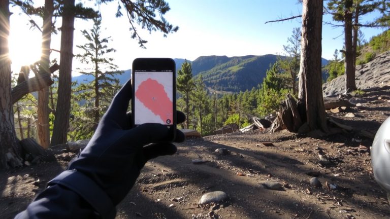
Even though trail ratings offer a helpful starting point, they’re not always consistent across regions or even trail types, so relying solely on a color or number can leave you unprepared. When choosing a trail, use tools like the onX Offroad App to check trail conditions and cross-reference Ratings with GPS data and user reviews. A Black Diamond Mountain bike trail in the USFS system isn’t the same as a Numeric 7–10 in off-road clubs-know the differences. Match your vehicle’s capability to the trail’s demands: lockers, winches, and skilled handling often matter on Difficult (5–6) routes. Trail conditions shift with seasons-rain or snow turns moderate paths into slick challenges. And remember, a Blue Square in the East might fool you compared to a steeper Western one. Be honest about your skill, read the terrain, and always prep gear accordingly.
On a final note
You’ll ride smarter by matching gear to trail reality, not just ratings. Look for wider tires-2.4 inches or more-for rocky descents, and lockout suspension helps on climbs. Use a hydration pack with 3L capacity for 2-hour rides. Trail colors aren’t universal, so check local reviews, recent conditions, and elevation gain-over 500 feet per mile means serious effort. Testers prefer dropper posts on variable terrain-they boost control without slowing you down.