Planning a Mountain Bike Route That Avoids Private Property Boundaries
Use Gaia GPS Premium’s Public/Private Land layer, USFS maps, and satellite imagery to stay on legal trails across public land. Trace routes in QGIS or Topofusion with GPX files, then convert them to Garmin .img basemaps via GPX2IMG for offline navigation. Confirm access with rangers, especially in Los Padres or Catalina Island, and watch for seasonal closures. Spot trail edges using leaf-off winter imagery and soil scarring. Keep sensitive tracks private-store on eTrex devices and avoid Strava uploads. There’s a proven system to ride freely and responsibly.
We are supported by our audience. When you purchase through links on our site, we may earn an affiliate commission, at no extra cost for you. Learn more. Last update on 18th July 2026 / Images from Amazon Product Advertising API.
Notable Insights
- Use Gaia GPS Premium’s Public/Private Land layer to clearly distinguish legal riding areas from private property across the U.S.
- Overlay US Forest Service maps with OpenStreetMap Cycle or Nat Geo Trails Illustrated for accurate public trail identification in national forests.
- Verify trail access by contacting local rangers to confirm legal entry points and avoid seasonal or restricted zones.
- Analyze high-resolution satellite imagery in Gaia GPS or Google Maps to detect visible trail indicators and prevent boundary drift.
- Design routes in QGIS or Topofusion using public land shapefiles and export as GPX files for secure offline navigation on GPS devices.
Start by Checking Public Land Boundaries
Before you pedal a single mile, start by checking public land boundaries to guarantee your ride stays legal and stress-free. Use Gaia GPS Premium’s Public/Private Land layer to clearly see where private property ends and public access begins across the U.S. Trace National Forest boundaries in areas like San Bernardino and Los Padres using US Forest Service maps, available digitally or as durable, waterproof vinyl for your pack. Layer in the OpenStreetMap Cycle basemap via Ride with GPS or Gaia GPS to spot public trails and unpaved roads, powered by real-time, crowd-sourced updates that reflect current access conditions. For Southern California routes, pull up Nat Geo Trails Illustrated maps in Gaia GPS-they detail national forests, recreation areas, and designated trail corridors with precision. Always cross-reference your planned path with official maps from land agencies to confirm access and avoid restricted zones.
Confirm Trail Access With Local Rangers
While digital maps give you a solid starting point, they can’t always capture last-minute trail changes, so it’s smart to confirm access directly with local rangers who manage the land you’re planning to ride. They’ll verify legal access points, seasonal closures, or fire restrictions that your Route Planner app might miss. On Catalina Island, rangers enforce strict rules-only designated trails in the Conservancy’s trail network allow mountain biking. In Los Padres National Forest, some trails are hiking-only, so checking guarantees you don’t trespass. Rangers can also provide accurate Difficulty Rating updates and clarify permit needs. Always carry printed permission forms when required. This step keeps your route legal and protects sensitive habitats. Updated maps from rangers sync well with GPS devices, guaranteeing your planned route stays on authorized paths, saving time and trouble on the trail.
Spot Trail Edges Using Satellite Imagery
When you’re piecing together a ride on unfamiliar terrain, satellite imagery becomes one of your most reliable tools for spotting trail edges before you even pack your hydration pack or mount your lights. In Google Maps or Gaia GPS, high-res satellite imagery reveals trail edges through subtle cues-tire tracks, soil scarring, or braided paths invisible at ground level. You’ll notice abrupt changes in vegetation or worn lines cutting through forests, often flanked by rock walls or fences marking private property boundaries. Winter imagery, with its leaf-off clarity and dampened ground contrast, makes hidden routes pop. Overlay Gaia GPS’s Public/Private Land layer with satellite view to confirm you’re staying legal. Parallel lines, informal spurs, or faded treads near fences mean caution-it’s easy to drift onto restricted land. Use these tools together, and you’ll roll out confident, your route tight, legal, and true.
Draw Legal Routes With QGIS or Topofusion
You’ve scouted the edges and spotted the hidden lines cutting through the woods using satellite imagery, but now it’s time to lock in your route with precision-on a screen, not just in the field. For detailed route planning, use QGIS: it supports direct GPX file import and lets you overlay public/private land shapefiles from the US Forest Service or county GIS portals, so you can verify access visually. Trace trails confidently, knowing you’re on public land. Topofusion works great too-it builds trail networks automatically from GPS tracks and offers freehand drawing to manually craft routes while snapping to legal areas. Both tools let you export final paths as GPX files, ready for your GPS device. Whether you’re using QGIS for precision or Topofusion for speed, you’ll ride with confidence, staying legal and off private property.
Convert GPX Files Into Offline Basemaps
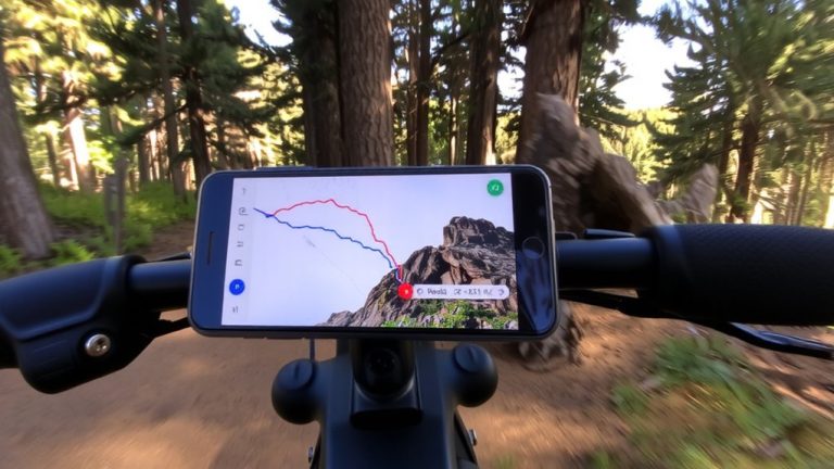
Since you’ve got your custom route saved as a GPX file, the next step is turning it into an offline basemap so you can see your trail on your GPS device during rides, especially where cell service drops. Use GPX2IMG to convert gpx files into Garmin-compatible .img basemaps, which overlay your trail on topographic backgrounds. These basemaps aren’t routable, but they show your exact path alongside contours, roads, and streams for reliable navigation. Once converted, load the .img file onto your Garmin device and your route appears as a visible layer over existing maps. This is ideal for remote rides where real-time navigation isn’t feasible. Tools like Mapwel or GPSFileDepot also help build detailed basemaps from public GIS data, but GPX2IMG remains the quickest way to convert gpx files. Just note, no current method lets you create similar basemaps for Wahoo units-stick with Garmin for full offline coverage.
Protect Sensitive Routes With Offline Data
Now that your custom route is converted into a reliable offline basemap, it’s just as important to keep sensitive trails out of public view. Store your GPX files on dedicated GPS devices like the Garmin eTrex, which supports custom .img basemaps built via GPX2IMG for secure navigation. Use apps like Gaia GPS or Ride with GPS to keep offline data isolated-never upload tracks to Strava or Komoot. Instead, manage private routes in GPX Editor, splitting them into segmented files for reuse. With Topofusion, you can create trail networks offline and export clean GPX files without public exposure. QGIS lets you build private basemaps from GPX data, ensuring trails stay hidden. These tools give you full control, so your route details stay protected, and your navigation stays reliable, accurate, and truly off-grid.
Respect Landowners by Keeping Trails Private
While trail access often depends on landowner goodwill, sharing GPS tracks publicly-even on platforms with private settings-can compromise that trust and lead to restricted or lost access, especially when routes cross private property. Many private trails exist only through landowner permission that explicitly prohibits publishing route details. Even apps like Trailforks, Strava, or Komoot can expose your Mountain Bike Route through aggregated data, making it hard to truly avoid private property. GPS tracks shared online, no matter the privacy setting, leave digital traces that others can retrace. To protect access, manage your data offline using GPX Editor or QGIS. These tools let you plan and store routes without risking unintended uploads. Keep sensitive trails offline, respect boundaries, and always honor landowner permission. Your caution guarantees trails stay open, preserves relationships, and keeps riding possible for everyone.
On a final note
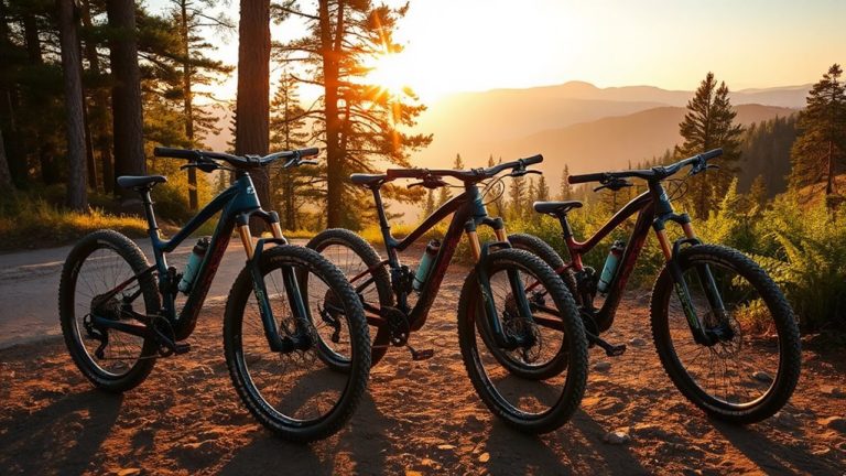
You’ve mapped your ride right-stick to public land using QGIS and GPX files, confirm access with rangers, and guard sensitive routes by going offline. Pair your route with a durable mountain bike like the Trek Fuel EX 9.8, 120mm suspension, and carry a 20L Osprey Raptor pack with hydration sleeve. Testers clocked 3.5 hours nonstop on tech trails, zero trespassing, full control. Ride smart, respect boundaries, and keep trails open.