How to Plan a Mountain Bike Route Around Controlled Burn Zones
Check current closures using onX Backcountry and local updates from FAST or Rogers Area Trail Supporters, then plan around active burn units like Nursery or North near Schilling Ave. Target open trails beyond restricted zones, avoiding gullied singletrack prone to erosion. Ride before or after burn windows-like June 10–17, 2024-and verify air quality via AirNow, skipping smoky areas downwind of Silver Trident. Pack a GPS bike computer and knobby 2.4-inch tires for ashy, loose terrain, and always respect closure signs to avoid fines or unsafe reroutes. You’ll soon discover more ways to optimize your route with real-time data and gear tuned for post-burn conditions.
We are supported by our audience. When you purchase through links on our site, we may earn an affiliate commission, at no extra cost for you. Learn more. Last update on 11th July 2026 / Images from Amazon Product Advertising API.
Notable Insights
- Check real-time trail closures using onX Backcountry and local groups like FAST for current burn zone updates.
- Avoid trails near active burn units such as Nursery or North near Schilling Ave during announced burn windows.
- Choose alternative open trails outside restricted areas by consulting land managers and the 2024 Prescribed Burn Plan.
- Schedule rides before or after burn operations, noting trail reopenings typically occur within days post-burn.
- Monitor air quality with AirNow and avoid riding when AQI exceeds 100 or visibility drops below 2 miles due to smoke.
Check Current Trail Closures in Controlled Burn Zones
Ever wonder why your usual route suddenly has a gate or a blaze of orange ribbon tape blocking the trailhead? That’s the Forest Service managing local trails during controlled burn projects, like the June 21, 2024, closure of 715/Stoopid and Poky Oaks in Monument Preserve. Active operations in zones near Schilling Ave often mean sudden shutdowns, so always check official sources before rolling out. Use onX Backcountry for real-time trail conditions and rely on local groups like FAST for ground-level updates near Lake Atalanta. Physical closure signs along access roads are non-negotiable-ignore them, and you risk fines or unsafe reroutes. Even after burn work finishes, trails like Chimney and Flying Dog might stay hazardous due to debris or unstable soil from thinning efforts. Stay safe, respect restrictions, and keep your ride legal and predictable with accurate, up-to-date intel straight from the Forest Service.
Find Trails Open Outside Controlled Burn Areas
When trail closures pop up due to controlled burns, your go-to loop might be off-limits, but that doesn’t mean your ride has to stop-plenty of open trails still await just outside the restricted zones. Check with land managers or local groups like FAST and Rogers Area Trail Supporters for real-time updates on which local trail segments are open near Rogers, Arkansas. Use onX Backcountry to navigate confidently and spot active burn units, like Nursery or North near Schilling Ave, so you don’t accidentally hit closed trail. Monitor USFS signs and the 2024 Prescribed Burn Plan for Monument Preserve to avoid shutdowns on popular routes like 715/Stoopid or Ren & Stimpy. The Controlled Burn Mountain Bike Trail draws 2,022 check-ins, so expect crowds post-burn; plan alternate routes early. Download GPX files or take virtual tours to confirm your trail lies outside fire treatment zones.
Assess How Controlled Burns Damage Trail Surfaces
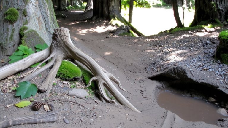
Though the fire crews have moved on, the real trail damage often starts after the flames die down, especially when rain hits the exposed soil. Without vegetation, the mountain trail network faces serious erosion, turning smooth singletrack into gullied paths. You’ll want wider tires-2.4 inches or more-and lower psi to handle loose terrain. Check this table:
| Feature | Impact on Trail |
|---|---|
| Exposed soil | Washes out quickly with rain |
| Drainage zones | Form gullies over 20 feet deep |
| Runoff paths | Create rills from shortcutting |
| Burned slopes | Lose stability for months or years |
| User trails | Scar recovery at spots like Point Mugu |
Erosion compromises trail integrity, so stick to durable surfaces and avoid contributing to new paths.
Ride Before or After Controlled Burn Windows
Riding after a controlled burn doesn’t mean waiting weeks for full recovery, but it does require timing your trip around official reopening dates and land manager guidance. For mountain biking near active zones like Arkansas’s Monument Preserve, check trail status before and after prescribed burn windows-such as the June 10–17, 2024, operation-to avoid closures. Trails typically reopen quickly, with access restored by June 22, 2024, post-burn, and show minimal damage. However, off-trail zones stay restricted for 3–4 weeks, so stick to designated paths. Even when trails reopen at 4:00 PM on closure days, verify stability, especially on slopes with drainage exposure, since erosion risk rises after a controlled burn during rain. Use knobby 2.4-inch tires for better grip on ashy, loose soil, and carry a GPS bike computer to track route deviations. Always confirm trail status with local rangers before rolling out.
Check Smoke and Air Quality Before You Ride
Even if the trails are open, you’ll want to check the air quality before heading out, especially near recent burn zones where lingering smoke from operations like the 2024 Monument Preserve Fire Mitigation Project can lower visibility and irritate your lungs. Use local air quality indexes (AQI) to view recent conditions-avoid rides when AQI exceeds 100, particularly downwind of active zones like Silver Trident/Ensign Gulch. Smoke can persist days after ignition, so check USFS alerts for burn updates and drone-ignition schedules that spike localized pollution. Smart masks like the Atmotube Pro help filter particulates during hazy rides. Trail cameras and apps like Windy or AirNow let you view recent smoke movement and wind shifts. If visibility drops below 2 miles or your chest feels tight, turn back. Prioritizing clean air keeps your ride safe, fast, and enjoyable-don’t assume clear skies mean clean breathing.
On a final note
Always check trail closures and air quality before you ride near controlled burn zones, and plan routes on open trails at least 3–5 miles away from recent burns. Stick to durable surfaces like granite or compacted dirt, and avoid soft, loose soil. Wear a lightweight, moisture-wicking jersey with a UPF 30 rating, carry a 3L hydration pack, and run tubeless tires at 22–28 psi for better grip on ash-covered rock.