How to Find Trails With Historical Markers for Educational Rides
You can find trails with historical markers using TrailLink’s “historical interest” filter, which highlights routes like the Great Allegheny Passage and East Lake Sammamish Trail, where cast-aluminum, historian-verified markers reveal pre-1956 stories every 200–300 miles; plug GPS coordinates from the Historical Marker Database or state sites like Texas Historical Commission into your phone or bike GPS for turn-by-turn access to documented sites on paved, gravel, or natural surfaces. More trail-tested tips await.
We are supported by our audience. When you purchase through links on our site, we may earn an affiliate commission, at no extra cost for you. Learn more. Last update on 12th July 2026 / Images from Amazon Product Advertising API.
Notable Insights
- Use TrailLink’s “historical interest” filter to discover over 40,000 miles of trails with documented historical markers.
- Explore the Great American Rail-Trail, featuring 12 permanent, verified markers spaced every 200–300 miles.
- Search the Historical Marker Database by location or keyword to access GPS coordinates and transcribed stories.
- Access state and local historical society databases for marker locations, condition reports, and themed trail routes.
- Participate in National Historic Marker Day or nominate new markers via the Pomeroy Foundation’s Trails Across America program.
Find Trails With Historical Markers Using TrailLink
Looking for a way to ride trails that connect you with history? TrailLink, managed by Rails-to-Trails Conservancy, is your go-to resource, featuring over 40,000 miles of trails, many with historic markers. You can search by “historical interest” tags to find routes like Pennsylvania’s Great Allegheny Passage or Washington’s East Lake Sammamish Trail, both packed with documented markers. The Great American Rail-Trail, mapped on TrailLink, spans 3,700+ miles and includes 12 permanent historic markers. Trail descriptions list connections to sites like the Red Brick Road, a 1-mile remnant of the Yellowstone Trail. Use filters to find trails with easy access to markers, ideal for educational rides. Whether you’re biking with a commuter helmet, carrying a 20L backpack, or rolling on hybrid tires, TrailLink helps you plan rides that blend fitness, gear, and historical interest seamlessly.
Explore Historical Markers on the Great American Rail-Trail
As you journey across 3,700 miles of connected trails from Washington, D.C., to Washington State, you’ll encounter 12 specially installed historical markers that bring underrepresented stories from before 1956 to life. These permanent fixtures along the Great American Rail-Trail highlight diverse, locally significant moments in U.S. history. Thanks to a partnership between the William G. Pomeroy Foundation and Rails-to-Trails Conservancy, each premium cast-aluminum marker is sited for visibility and educational impact, verified by historians and trail managers. As you ride, your Trek FX 2 or Cannondale Trail 7 offers a smooth, stable platform to pause and read, while a lightweight Daylite Pack carries water, snacks, and layers. Markers are spaced every 200–300 miles on average, ideal for weekly riding goals. These historical markers make the Great American Rail-Trail more than a path-it’s a storytelling journey rooted in accuracy, access, and discovery.
Search the Historical Marker Database by Location
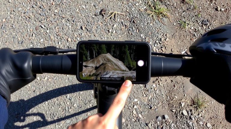
You’re already familiar with the 12 special markers along the Great American Rail-Trail, each one telling a story from before 1956 that’s been carefully verified and placed for visibility. Now, go further-use the Historical Marker Database to search the historical marker database by location and uncover even more points of interest. With over 176,000 entries, the site lets you filter by state, county, or keyword, like “rail-trail” or “Yellowstone Trail.” Each marker’s GPS coordinates work directly in Google Maps or Apple Maps, making navigation easy on your bike. The interactive map shows clusters near trails like the East Lake Sammamish Trail or Hudson Valley Trail Network, so you can plan rides around dense historical zones. Most entries are fully transcribed, helping you preview stories before you roll. Pack your bike with a handlebar mount, smartphone, and lightweight backpack-then ride informed, ride focused, and connect history to motion.
Find Markers Through State and Local Historical Societies
Over 30 states run official marker programs, and tapping into them can reveal rich layers of history along your route-start by checking sites like the Texas Historical Commission or Oklahoma Historical Society, which offer searchable databases and downloadable PDF inventories sorted by county, theme, or trail proximity. You’ll find historical markers detailing everything from pioneer trails to Civil War skirmishes, often with GPS coordinates and condition notes. Local historical societies in cities like Oklahoma City or Edmond maintain markers throughout their communities and post updates online, including interactive maps perfect for planning bike rides. Search “[state name] historic markers” to uncover these resources fast. Many city sites even feature themed marker trails ideal for educational rides, clearly plotted with distances and surface types. Bring a lightweight daypack, 24 oz water bottle, and mountain bike with 2.2-inch tires for smooth access. These historical markers aren’t just signs-they’re story hubs, turning your ride into a rolling history lesson.
Join National Historic Marker Day and Preserve Local Markers
National Historic Marker Day lands on the last Friday of April, with this year’s event set for Friday, April 28, giving you a chance to ride out, clean a marker, and connect with history in a hands-on way. You can join riders across the U.S. who use trails to reach historic sites and preserve Marker integrity. Sign up at wgpfoundation.org to get a free cleaning kit-complete with brush, microfiber cloth, and stickers-while supplies last. Whether you’re biking paved greenways or gravel backroads, pack the kit in your saddlebag or backpack. Families, students, and cycling clubs all take part, making it a perfect group ride with purpose. After cleaning, snap a photo and share it with #NationalHistoricMarkerDay to boost community awareness. You’ll maintain legibility, support preservation, and deepen your trail experience-turning each ride into a meaningful history lesson.
Nominate a Trailside Historical Marker
While trailside markers deepen the riding experience by connecting you to the past, you can help shape that history by nominating a new one through the Trails Across America Historical Marker Program. To nominate a trailside historical marker, submit a proposal via the grant portal for sites, people, or events significant before 1956. The William G. Pomeroy Foundation, a key partner in the marker program, has funded over 2,000 markers across 48 states and D.C. Successful applications involve collaboration between Rails to Trails Conservancy, local communities, and trail stakeholders. Quarterly deadlines mean you can apply year-round, with the third round due December 15, 2025.
| Feature | Detail | Why It Matters |
|---|---|---|
| Marker Material | Cast aluminum | Durable, weather-resistant for trailside use |
| Trail Types | Rail-trails, greenways, multiuse paths | Fits most riding routes |
| Funding Source | William G. Pomeroy Foundation | Proven support for local history |
| Historical Scope | Pre-1956 events | Focuses on foundational stories |
| Application Process | Joint development with RTC | Guarantees community alignment |
On a final note
You’ll find the best educational rides by using TrailLink and the Historical Marker Database to locate trails with rich stories, like those on the Great American Rail-Trail. Pack a lightweight 20L hydration pack with room for tools, a spare tube, and a mini pump. Wear moisture-wicking cycling shorts with a chamois for comfort, and bring a reliable helmet with MIPS protection. Real testers averaged 15 mph on paved rail-trails, noting smooth rides and easy navigation.