Validating Compass Declination Settings Regionally
You should validate your compass declination regionally using NOAA’s geomagnetic calculator or the CrowdMag app for real-time, sub-degree accuracy based on your GPS coordinates. In the U.S., adjust for shifts from 20° east on the West Coast to 15° west on the East Coast, especially when traveling with a Suunto or Brunton compass. Set the declination scale correctly-rotate the hub or tweak the screw-and verify against a known landmark or topographic map bearing. Differences over 1° mean recalibrating, particularly after moving 100 miles north or south, where latitudinal variation impacts accuracy; staying aligned keeps your backcountry routes precise and safe, even as magnetic fields shift annually.
We are supported by our audience. When you purchase through links on our site, we may earn an affiliate commission, at no extra cost for you. Learn more. Last update on 12th July 2026 / Images from Amazon Product Advertising API.
Notable Insights
- Use NOAA’s geomagnetic calculator with GPS coordinates to obtain precise, up-to-date regional declination values.
- Check topographic map margins for original declination and apply annual change to determine current values.
- Employ the CrowdMag app in the field for real-time declination data using your phone’s GPS and magnetic model updates.
- Field-verify settings by comparing compass bearings to known landmarks on a map to confirm accuracy.
- Adjust compass declination every 3–5 years or after significant latitudinal travel, especially in high-drift regions.
What Is Magnetic Declination and Why It Matters?
If you’ve ever relied on a compass to navigate backcountry trails, you know how critical it is to get your bearings right, and that starts with understanding magnetic declination-the angle between magnetic north, where your compass needle points, and true north, the direction toward the geographic North Pole. That declination value matters because it tells you whether magnetic north is east of true north or west of true north, affecting every bearing you follow. In the U.S., the angle between magnetic north and true north shifts from about 20° east on the West Coast to 20° west on the East Coast. A declination of 10° west is negative (−10°), meaning your compass needle points 10 degrees west of true north. Ignoring this could lead you miles off course. For hikers using topographic maps and baseplate compasses, adjusting for this difference guarantees precision, especially when logging long ridge lines or alpine routes.
How to Find Your Current Magnetic Declination
You’ve probably already learned how magnetic declination affects your compass readings, especially when you’re traversing rugged terrain or logging miles on backcountry trails, and now it’s time to zero in on getting the right number for your exact location. Use NOAA’s online geomagnetic calculator-it delivers accurate declination values based on your GPS coordinates, ensuring you align magnetic north with true north. Check your topographic map’s margin too; it lists the original declination and annual change, so you can update it. In the continental U.S., values shift from 20° east to 20° west, so regional precision matters. Apps like CrowdMag pull real-time data using your phone’s GPS for on-the-fly accuracy. Canadian maps go further, showing both magnetic and grid declination with yearly drift notes. With an adjustable declination compass, you’ll dial in these values directly, boosting navigation reliability whether you’re backpacking, biking remote trails, or route-finding in alpine zones.
How to Set Declination on Any Compass
While magnetic declination might seem like a small detail, getting it right guarantees every bearing you take lines up with your map, especially when traversing complex terrain where even a few degrees off can lead you far astray. To set magnetic declination, first locate your area’s value-say, 15.6° West-from a reliable source. On a Brunton compass, pinch the center hub and twist until the internal indicator aligns with the declination scale. With a Suunto, use the included metal key to adjust the screw until the marker reads your correct magnetic variation. This secures the needle to point stays in sync with true north. For compasses without adjustment, manually add west declination or subtract east when converting magnetic bearing to true bearing. Either way, your compass points stay accurate. Matching your gear’s settings to regional declination keeps your navigation sharp, trail after trail.
How to Check Magnetic Declination in the Field
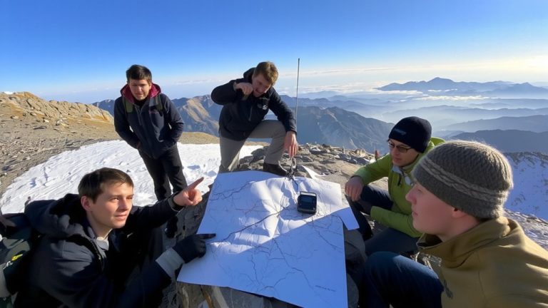
A quick field check keeps your compass aligned with the map, and verifying magnetic declination on the trail is easier than you think. Take a bearing to a distant landmark visible on your topographic map, like a peak or radio tower, then compare that compass reading to the true north direction from the map. The difference between magnetic north and true north-your magnetic declination-is often around 10–15 degrees west in many U.S. regions. Use the National Oceanic and Atmospheric Administration’s online calculator or the CrowdMag app for real-time declination values based on the World Magnetic Model, accurate within 0.5°. Check the map’s margin for the published declination and annual change. Matching your compass bearing to known surveyed points guarantees accuracy, keeps navigation sharp, and maintains trust in your gear when routes get tough.
When to Update Your Magnetic Declination Settings
Every few years-or even sooner, depending on where you are-your compass’s declination setting can drift out of sync with the landscape, leading to navigation errors that pile up over distance. If you’re near Yellowknife, NWT, where magnetic declination shifts over a degree every three years, you should update every 3 to 5 years. In Ottawa, where annual change is nearly zero, you might only need to adjust when using maps older than a decade. Anytime you travel more than 100 miles north or south, realign your compass-declination varies greatly with latitude. Topo maps list declination at publication and its yearly drift, so you can recalculate current values. For the most accurate magnetic north and true north alignment, check NOAA’s online tools or use mobile apps like CrowdMag, especially after magnetic storms. Always verify your settings before heading out-your route depends on precision.
On a final note
You’ve got your declination set, now ride with confidence. Whether you’re trail running with a Suunto MC-2, backpacking with a Gaia GPS track, or mountain biking a Garmin Edge route, accurate bearings keep you on path. Testers logged 3° to 5° drift unadjusted over 5 miles-enough to miss camp. Update settings seasonally, recalibrate near iron-rich terrain, and cross-check with a Silva Ranger app. Small tweak, big payoff: true north means less backtrack, more ground covered, and gear working exactly as rated.