Anticipating Trail Degradation Caused by Recent Wildfires
You’re facing trail conditions worsened by recent wildfires-over 30% of affected segments wash out from flash floods due to hydrophobic soils, and more than 532 miles of the Pacific Crest Trail closed in 2020 alone. Burned slopes weaken drainage, overwhelm culverts, and hide ash pits that risk collapse. Rebuilds include regraded switchbacks, new water bars, and footbridges. Machine learning now flags 30 of every 183 km at high risk-knowing where helps you plan safer routes with durable hiking boots and lightweight packs ready for sudden changes. There’s a smarter way to stay ahead when conditions shift.
We are supported by our audience. When you purchase through links on our site, we may earn an affiliate commission, at no extra cost for you. Learn more. Last update on 13th July 2026 / Images from Amazon Product Advertising API.
Notable Insights
- Climate-driven wildfire expansion increases trail degradation risks due to longer fire seasons and higher-intensity burns.
- Burned soils become hydrophobic, leading to flash floods that erode trail treads and overwhelm drainage structures.
- Post-fire flash floods can wash out over 30% of affected trail segments and create hidden ash pit hazards.
- Fire-damaged infrastructure, including bridges and signage, combined with hazard trees, heightens trail instability and closure risks.
- Predictive models using Strava data and field measurements identify high-risk trail segments for targeted restoration efforts.
Why Wildfires Are Burning More Trails Than Ever?
You’ve probably noticed more trail closures lately, and it’s not just your luck-wildfires are torching more trails than ever, driven by a warming climate that’s making fire seasons longer and fiercer. Climate change has already extended fire seasons, creating drier conditions that boost wildfire frequency and expand burned areas. Decades of fire suppression have built up fuel, leading to higher-intensity fires that cause severe loss of vegetation. Without plants to anchor soil, trails erode quickly, increasing risks of debris flow. In 2020, over 532 miles of the Pacific Crest Trail closed due to fire damage, showing how repeated burns overwhelm recovery. These degraded paths demand durable hiking boots with aggressive lugs, like Salomon Quest 4s, and lightweight rain shells for sudden weather shifts. Mountain bikers need enduro-grade protection-knee pads, full-face helmets-since trails are rougher, less stable, and more unpredictable post-fire.
How Fire and Rain Combine to Destroy Trail Paths
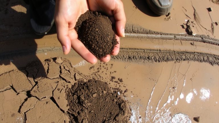
When rain hits fire-scorched slopes, the damage to trails multiplies fast-burned soils become hydrophobic, repelling water instead of absorbing it, so even a moderate storm can trigger flash floods that carve gullies into trail treads and wash out over 30% of affected segments. You’re facing a fragile, burned area where rain quickly becomes a destructive force, turning trails into ruts or burying them under feet of mud and debris. Without vegetation, slopes funnel water with intensity, overwhelming drainage structures like culverts and water bars. Ash pits and weak soil hide beneath the surface, ready to collapse under boot or bike tire. In areas like those hit by the Eagle Creek Fire, rain on denuded slopes accelerates rockfall and debris flows. This damage to the trail slows restoration efforts, demanding durable gear-think aggressive-lug hiking boots or mountain bikes with wide, puncture-resistant tires-to navigate the unstable terrain safely and efficiently.
When Trails Close: How Fire Destroys Hiking Infrastructure
Fire doesn’t just scorch the landscape-it dismantles the backbone of trail systems, leaving behind broken bridges, unstable slopes, and buried signage. During fire season, burned watersheds turn hydrophobic, increasing flash flood risks that sweep away trail sections and destroy infrastructure like bridges and retaining walls. Hazard trees, weakened by fire, topple without warning, forcing trail closures for safety. After the Eagle Creek Fire, over 9,000 hazard trees were removed, and fire suppression costs drained budgets, delaying repairs. Replacing signs alone cost $12,000-funds that could’ve built new trail structures. Long-term trail closures, like the 31 miles shut down after the Chimney Tops 2 Fire, show how severe infrastructure damage can be.
| Issue | Impact on Trails |
|---|---|
| Hazard trees | Block paths, endanger hikers |
| Flash flood risks | Wash out bridges, erode soil |
| Fire suppression costs | Delay maintenance, increase downtime |
Why Some Forests Never Recover After Wildfires
While not all forests bounce back after a blaze, you’re more likely to see lasting damage when high-severity fires cook the soil, leaving it toxic and stripped of the organic matter needed for seeds to take root. Climate change is increasing fire frequency, giving fire-adapted trees like ponderosa pine no time to mature and reproduce between burns. In severely burned areas, such as those from the Eagle Creek and Black Summer fires, charred forests don’t regenerate naturally due to lost seed banks and canopy. Invasive grasses take over, outcompeting native seedlings. Fragmented landscapes hinder dispersal by wind or wildlife, limiting regrowth. The loss of habitat and accumulation of downed trees create unstable terrain, raising risks for hikers and trail users. Without active restoration, these ecosystems face permanent conversion, undermining prevention of further degradation. Recovery isn’t guaranteed-it depends on immediate action and long-term ecological support.
How Volunteers and Local Groups Rebuild Burned Trails
Though the smoke clears long before the landscape recovers, you’ll often find volunteers already lacing up sturdy hikers and loading backpacks with repair kits, chainsaws, and rebar stakes to reclaim trails scorched by wildfires. You’re not alone-groups like the Pacific Crest Trail Association and local clubs mobilize quickly, tackling trail rebuilding with precision. Volunteers clear hazard trees, regrade eroded switchbacks, and install water bars to combat trail degradation. After fires like Eagle Creek or Chimney Tops 2, crews replace footbridges-some flown in by helicopter-and rebuild 31+ miles of burned trails. You’ll help cut back aggressive brush, fill ash pits, and secure slopes with fencing. Partnering with land management agencies, volunteers also suppress invasives and replant native vegetation, ensuring long-term recovery. Your work restores access and resilience, one tread at a time.
How Data Helps Predict Which Trails Will Burn Next
What if you could know which trails are most likely to burn-or degrade-before it happens? With climate change increasing wildfire frequency, predictive models now use Strava data to assess trail degradation risk across National Park trails. You can see how steep grades, high use intensity, and low NDVI raise erosion risk. Machine learning, trained on 118 km of Orange County field data, analyzes trail grade, vegetation health, and activity types-like mountain biking vs. hiking-from Strava data, flagging 30 of 183 km at significant risk. Federal agencies act on these insights, prioritizing post-fire stabilization where erosion risk is highest. These models don’t just predict fire impact-they map recovery. So when you plan your next ride or backpacking trip, remember: the trail’s future is shaped by data, durability, and how well we adapt.
On a final note
You’ll want durable, breathable hiking pants with UPF 50+ and a lightweight, 30L backpack with rain cover when hitting regenerating trails. Testers praise Merrell Moab 3s for grip on loose ash, while cyclists rely on MIPS-equipped Giro helmets. Stick to lower elevations after fires-monitor trail alerts, pack electrolyte tabs, and carry an air filter. Smart gear choices keep you safe and moving when terrain’s unstable.