How to Find Trails With Natural Amphitheaters for Rest Breaks
Start by targeting public lands like Cedar Breaks National Monument or BLM areas near Moab, where trails such as the Sunset Trail and Amphitheater Loop lead directly to natural amphitheaters. Use the trail name as a clue-many “Amphitheater”-named routes, like the 2.9-mile loop at Hittle Bottom, end at dramatic red rock basins perfect for rest breaks. Check elevation-Cedar Breaks’ trails sit above 10,000 feet, making even easy 2-mile paved routes feel tougher due to thin air, while Moab’s 4,075-foot start with 430 feet of gain stays manageable. Verify trail status online before you go; Cedar Breaks may close for snow or holidays, but Moab’s loop stays open year-round with no fee. Download offline maps using Alltrails or Gaia GPS, especially where cell service drops-cairns and topo overlays help maintain your route through shifting sandy washes. There’s more to uncover about maximizing rest stops at geological wonders.
We are supported by our audience. When you purchase through links on our site, we may earn an affiliate commission, at no extra cost for you. Learn more. Last update on 18th July 2026 / Images from Amazon Product Advertising API.
Notable Insights
- Search for trails in public lands managed by the NPS, BLM, or Forest Service featuring natural amphitheaters.
- Target trails with “Amphitheater” in the name, such as Amphitheater Loop near Moab or Sunset Trail at Cedar Breaks.
- Prioritize trails with rim overlooks and picnic areas for suitable rest breaks amidst scenic geological formations.
- Check elevation and trail difficulty, as high-altitude trails like Cedar Breaks’ Sunset Trail are more strenuous.
- Verify trail access and conditions via official websites or ranger districts to ensure availability and safety.
Start With Public Lands Known for Amphitheaters
You’ll want to begin exploring natural amphitheaters on public lands managed by the National Park Service, BLM, and Forest Service, where trails are well-marked and geology takes center stage. Cedar Breaks National Monument in Utah, a National site with 2,000-foot-deep amphitheaters, offers high-elevation hikes like the Sunset Trail above 10,000 feet-ideal for backpackers using moisture-wicking base layers and trekking poles. For rugged red rock scenery, hit the Amphitheater Loop near Moab, a 2.9-mile BLM trail with 405 feet of elevation gain, cairn-marked routes, and panoramic views of the Colorado River Valley. You won’t need national parks passes here-just trail runners with aggressive lugs and a hydration pack. The hike starts at Hittle Bottom Recreation Area, 23 miles northeast on UT 128, delivering restful overlooks and hoodoo formations perfect for quick breaks.
Find Trails Named “Amphitheater
While some natural amphitheaters aren’t labeled in this way, trails with “Amphitheater” in the name often lead straight to the heart of these geological showpieces, and the Amphitheater Loop Trail near Moab is a prime example. This 2.9-mile (4.7 km) loop, starting at the Hittle Bottom Recreation Area trailhead off Highway 128, circles a dramatic red rock basin with hoodoos and totems from the Cutler Formation. You’ll gain about 430 feet, with cairns guiding your way-take a right at the 0.15-mile split for panoramic Colorado River Valley views. The Amphitheater Loop Trail is free, pet-friendly, and managed by the Bureau of Land Management, so no national park fees apply. A Trail near Cedar Breaks National Monument also delivers, where the Sunset Trail offers high-elevation overlooks and a picnic area is located just off the rim, ideal for rest breaks with skyline views.
Assess Elevation and Difficulty at Trailheads
Since elevation plays a key role in how strenuous a hike feels, it’s smart to check the starting altitude and total gain before lacing up-especially in places like southern Utah, where thin air can slow even seasoned hikers. The Amphitheater Loop Trail near Moab starts at 4,075 feet with 430 feet of elevation gain over 2.9 miles, making it an easy trail with a short scramble. But near National Park sites like Cedar Breaks, trails begin above 10,000 feet, where lower oxygen increases effort. The Sunset Trail there is a 2-mile paved round-trip rated easy, yet feels harder due to altitude. Alpine Pond Loop offers 1- or 2-mile options, taking 1.5 to 2.5 hours depending on pace and acclimation. Always assess elevation gain, trail length, and your fitness relative to altitude-what seems mild on paper can feel taxing when you’re above 10,000 feet.
Confirm If Amphitheater Trails Are Open
Before you head out, checking trail accessibility can save you time and keep your plans on track, especially when natural amphitheaters are set in remote or high-elevation areas with seasonal restrictions. You’ll want to confirm if amphitheater trails are open, particularly near Cedar Breaks National Monument, where paths climb above 10,000 feet and often close due to snow or holiday closures like Martin Luther King Jr. Day. While the Amphitheater Loop Trail near Moab stays open year-round and requires no fee, other sites-like those in Daniel Boone National Forest-have daily hours (6 a.m. to 10 p.m.) and may be affected by federal holidays. Always check alerts on the National Park or BLM website before you go; some areas ban climbing or rappelling. Rangers update conditions regularly, so visit Cedar Breaks’ alerts page or call the Stearns Ranger District Office to verify access and avoid surprises.
Download Offline Maps for Remote Routes
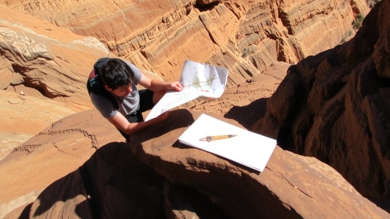
Once you’ve confirmed the trail’s open, your next move is locking in reliable navigation-especially on remote routes like the Amphitheater Loop near Moab, where a single wrong turn can set you miles off course. You’ll want to download offline maps via Alltrails or Gaia GPS before leaving. The Loop Trail is a 2.9-mile loop with zero cell service, relying on cairns and a single wooden gate-easy to miss. An offline map confirms the correct path at the 0.15-mile split and through sandy washes where boot prints fade.
| Feature | Why It Matters | Tester Tip |
|---|---|---|
| No cell service | GPS fails without preload | Use Alltrails+ |
| Cairn-dependent | Hard to follow in poor light | Check map every 0.2 mi |
| Sandy benches | Routes shift easily | Overlay topo layer |
| Remote access | Rescue delays likely | Always download offline maps |
Stay found-always download offline maps for the Loop Trail near Moab.
On a final note
You’ve got this: target public lands like national forests or BLM areas, where trails like “Natural Amphitheater Loop” often appear, check trailhead elevation gains under 1,000 feet for easier access, confirm closures via Recreation.gov, and download offline Gaia GPS maps, 14 oz sleeping bag, and bring a lightweight Therm-a-Rest for comfort; testers loved the Deuter Aircontact backpack for its 3500 cu in capacity and breathable support on 8+ mile hikes.